

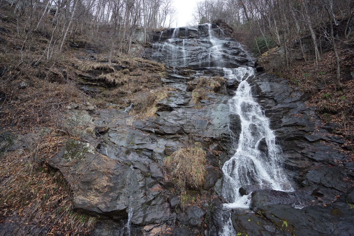
If you like boxing for 8 rounds, and not having it count, by all means do the Approach Trail. Sure, the falls are the tallest east of the Mississippi, and sure the steadily uphill 8.8 mile trail isn’t too hard, but it resulted in us hiking 11.6 miles where only 2.8 counted on the actual AT. There are some benefits of the Approach. Firstly, it’s cheaper to get a shuttle there from the North Springs MARTA station. We used Survivor Dave’s shittle, a bombastic thru hiker alumni who charged us $95 for the two of us. Second, the falls are rather stunning, and you can see the whole cascade as you climb 403 steps to the top. Finally, you don’t have to start your hike backtracking one mile south to Springer Mountain. As we all know, one can never truly trust a southbounder.

On March 1st, we started walking north, and stood on top of Springer Mountain, the southern terminus of the Appalachian Trail. Rain was on the horizon, so we didnt linger. Our first steps were more like leaps, as we both wanted to jump into this new adventure with both feet. This was a little tradition of mine, as I did the same for the PCT.

Minutes before reaching our first camp and shelter, it started to rain. We hoofed it and luckily got to Stover Creek Shelter before getting too soaked.
Stover Creek Shelter is nice, with a loft and center aisle separating the bottom level. There are a bunch of tent spots as well. The water isnt too close, about .25 up the trail. Thunder boomed overhead, while one lightning bolt in particular was so close, it caused us to see spots. Those in the shelter weren’t safe from the rain. It blew sideways and misted everyones sleeping bags, an inauspicious way to start the trail. But, as they say, “No pain, no rain, no Maine.” Others weren’t as lucky as us, like Good Life, who’s tent was ripped from his hands and soaked as he tried to set it up in time.
We barely slept. Not because of the rain, not becuase of the cold, but because of the snoring. Certain hikers, lets call them “older” hikers, love sleeping in shelters. Knowing full well of their snoring, they lack any sort of selflessness and set up right in the thick of things. That first night, I slept for about an hour, and spent the other 8 listening to a symphony of gurgles. I am not being dramatic when I say the floor shook. We were not amused.
We left the shelter at around 9am the next day, excited to get deeper into the woods. We made it to Hawk Mountain Shelter in a few hours and took a break. Apparently, upwards of 30 people had slept in and around the shelter that night. So much for escaping the bubble.
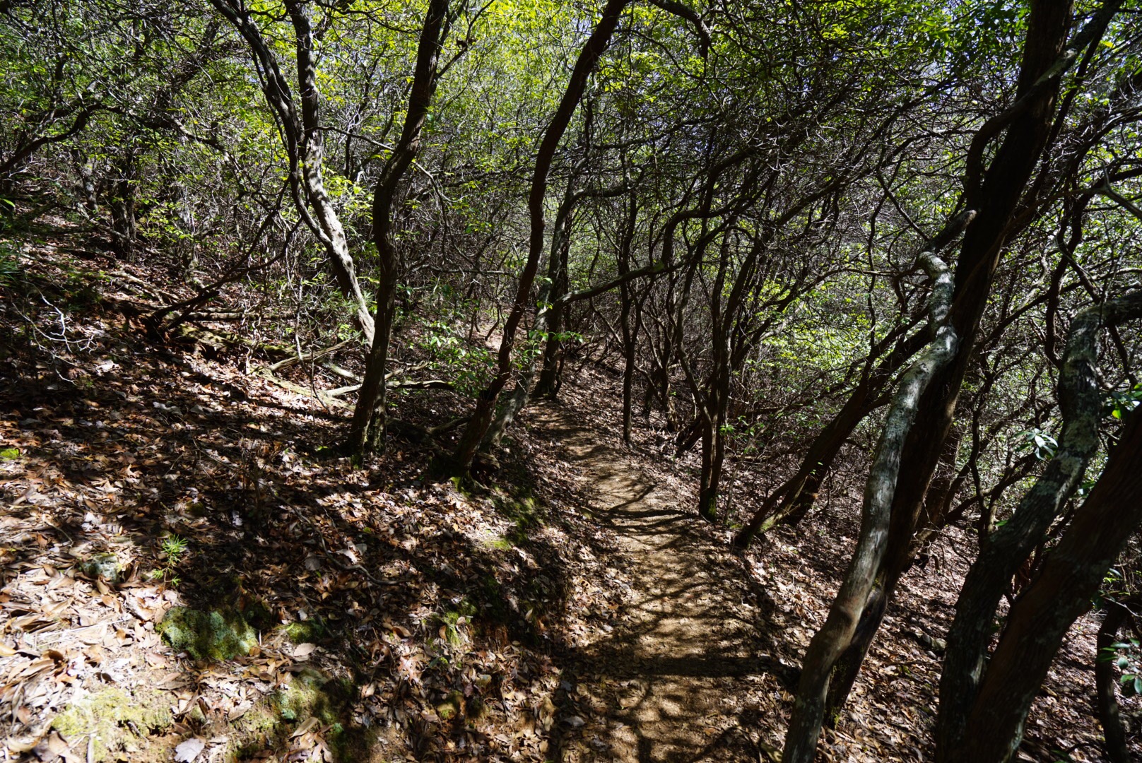
We pushed on to Gooch Mountain Shelter, passing hikers throughout the day. Only during a thru hike would it be normal to say to someone, “See ya at Gooch!” The trail in Georgia is wondeful. Not too rocky, and the climbs aren’t too drawn out. A particularly beautiful spot is Justus Creek a few miles before Gooch. We had our first real climbs of the trail, Sassafras and Justus mountains, but even those weren’t too bad.

Gooch Mountain Shelter looked more like a Hooverville in the woods, than anything else. Stretching down the steep embankment lay scattered tents of various colors and fabrics. Legs and I had not learned our lesson and grabbed two spots on the lower bunk of the shelter. We slept next to, you guessed it, three consecutive older gentlemen who took turns ruining our nights sleep for the second time in a row. Fool me once…blah blah.
Besides the snoring, and occasional shelter mice running over you while you sleep, shelter life isn’t that terrible. The AT is a social place, and shelters serve at trail pubs, where hikers can eat and drink together with perfect strangers, only to be good friends by the next morning. Wonder Woman, Thread, Tailgate, Riddler, B10, Stitch, Gray, Goodwitch, Torro, 8 Track, Sunshine and Dreamliner were just some of those we met and would hike with in the coming days. We slept maybe 2 hours that night, though the shaking floor boards did get a few knots out of my back.

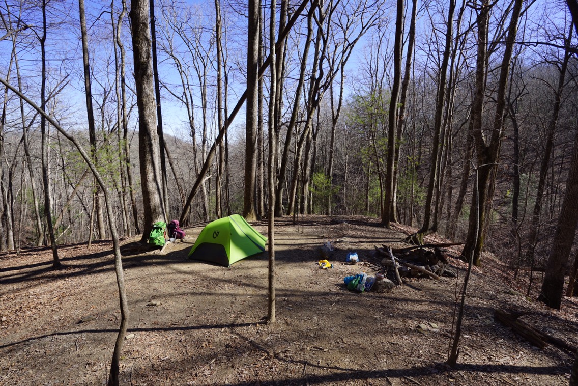
From Gooch, we headed North hoping to get to Woods Hole Shelter. Unfortunately, Woods Hole lacked water, and Legs was having some hips problems. Instead we stopped about 3 miles early and grabbed a sweet little tent site near Lance Creek. In 2013 when we did this section, we had slept at Lance and knew of a nice, little protected spot far from the snorers. To reach this spot head past the first tent spots and the bear cables all the way to the end of the trail where a small spit of flat land juts out over the creek gorge below. It’s marked with a stone campfire ring, and has room for one tent if you place it just right. Basically, if you dont want neighbors, take the whole spot. That night would be the coldest yet, dropping below freezing, the frost on our water bladders as evidence. We made a small fire, and shared it with another couple, Hondo and Turtle, who were camped about 100 feet away.

The trail is a funny place and makes for strange bedfellows. Rarely do religion and politics come up, so there’s hardly anything to fight about. We chatted with Hondo, a middle aged, and self proclaimed conservative from the south, for hours, laughing and finding common ground in many things. Off trail, it’s likely we never would have met let alone had a long and interesting conversation.
From Lance, our next destination would be Neels Gap, but we would first have to cross over the dreaded, cursed, mountain of doom named Blood. Blood Mountain and nearby Slaughter Creek got their gruesome nomenclature from a bygone Native American battle between two warring tribes. It’s said the rivers ran red. Blood Mountain, if you frequent online hiking forums, is described in the same way one talks about Everest, or maybe K2. Keyboard walkers would have you believe that the climb is long, arduous, and even…deadly!? In reality, it’s nothing more than a few long, barely inclined switchbacks, where you reach the summit about ten minutes after realizing you’re on the mountain. Going down is a different story, with a knee shredding descent into Neels Gap.


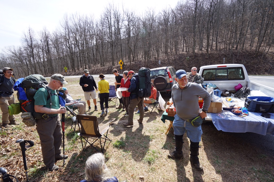
Our first resupply point and 31 miles into the trail sits Neels Gap. Most hikers resupply here at Mountain Crossings, a quasi general store/outfitter literally on the trail at the gap. A large tree next to the building serves as a shoe graveyard, the remains of the 25% of attempting hikers that get off here, only 30 miles in. You can buy a full resupply, and any thru hiking gear here, though dont expect anything to be cheap. There is a hiker box (a box where hikers put unwanted, but useable gear/food they dont want for other hikers to pick through. Usually, it’s just oatmeal and trailmix as those are the first to be ditched after 3 days.) but I wouldn’t rely on it. We had sent ourselves “mail drops.” Two flat rate boxes stuffed with the usual fare; nuts, jerky, pasta, pepperoni, fruit snacks, poptarts, etc. We also got some, erm, safety supplies as well.


Legs was still struggling with her hip so we stopped at Neels and rented cabins at Blood Mountain Cabins. Mountain Crossings has a hostel for $18 a night, but if you can get 4 people together a cabin costs the same thing, while also getting more privacy, free showers, and amazingly free laundry. The cabins were about a quarter mile down the road.
One of the best parts of thru hiking is the community. People called Trail Angels will come toknown hiker areas and give Trail Magic. Magic can be anything from a ride to town, to free food and drinks, to a warm bed and shower. We had our first trail magic at Neels Gap, from a woman named Kathy. Her husband is hiking the trail and goes by 8 Track. The magic took the form of irresponsibly strong mixed drinks served from their RV. Kathy would raise the giant glass jug labelled, “Vodka 100 Proof” and say, “Tell me when!” By the time you had said when, half the cup was filled. Two of those and you were man down, and certainly some hikers had some headaches the next day. All in all, about 15 of us hung around, drinking and being silly, something we would continue doing late into the night.
The trail out of Neels is awesome. It goes up in the beginning, but quickly turns into a long ridge walk, where in this early season, the views stretched out in both directions. To those hiking in the future, if you’re looking for good camp spots, check out Wolf Laurel Top and Cowrock Mountain. Both offer sweeping views and beautiful sunsets over the southern Appalachians.

Ridge walking would be the theme of the day, with relatively gentle climbs and descents. Legs and I are pretty quick hikers, so we were cruising.
Sometimes moving fast has it’s pitfalls, as we apparently just missed trail magic at Tesnatee Gap in the form of hamburgers. Fret not however, as we were getting magic in the next gap over, Hogpen. (I should mention that a gap is a break in the mountains, usually where a road has been built for people to get across easily.)
Mitsy and Bobby have been giving magic to hikers for close to three years now. As Bob poured the thick chicken and vegetable soup into my bowl, I could have kissed him. When you’re on trail, everything tastes better, but this soup was something I’d buy at a restaurant. That’s how good it was. Fresh veggies and water, along with home baked cookies rounded out our magic meal. Bellies full and hearts contented, we set off for Low Gap Shelter.
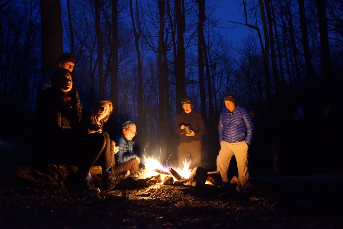
As I mentioned before, we are in somewhat of a hiker bubble, so getting to camp earlier is key for finding a spot to sleep. We are done sleeping in the shelters themselves, so we needed a tent site. I think I hiked the last four miles to camp in just an hour, and was able to grab a great spot. Soon the slower hikers began pouring in. I’d estimate somewhere between 25 and 30 people slept in Low Gap that night. A fire was kindled, and like moths to a flame, we all gathered round for some “hiker tv.” At hiker midnight, also known as sundown (so like 7:00pm at this point), we all retired to our respective nylon dominions. The sound of gentle rain on our tent lulled us to sleep.

From Low Gap, we started walking in full rain gear as the sky was threatening us with what looked like a pregnant belly. It’s interesting that as soon as you make the decision to stop hiking and put on your full rain shell,the rain seems to stop. Then when you start getting hot because you’re hiking in said rain gear, you stop to take it off. It’s about 10 seconds after you get your obnoxiously large boot through your obnoxiously small pant leg when you start feeling drops again. I told Legs we should just keep our rain gear on so it never rains. If only.
We made it 7.3 miles in 2 hours and 10 minutes despite the wet trail and surprising amount of rocks. Legs, who’s cough followed her from the tropics of Costa Rica several weeks ago, finally broke and said she needed to see a doctor. We checked our maps and saw there were medical services in a town called Hiawassee. We would need to hike another 2ish miles down to Unicoi Gap, and hitch 11 miles into town. We did so with little to no problem. We got a hitch after maybe 15 minutes from a woman heading into town. As I write this, Legs is in the doctor and I am sitting in Ingles, eating a full rotisserie chicken to myself, and reading up on the trail ahead. It may come to us staying in town, but I could think of worse problems. I hike north with my Love for many more months to come. 
Until next time, Darwin out.

Awesome!!! Hope Nicole is feeling better by this time! xo
Happy trails to you both!! Feel better Nicole. Good food and warm showers await you in PA!
My preciosa, I am SOOO impressed. Your adventure is stunning and you look like Superwoman, all muscle and courage and gorgeous. I love you. I hope you can rest and get over that ugly cough. Mai
I am living vicariously through your amazing adventure. So happy for both of you.