Starting Point: Pearisburg, VA Mile 634.3
End Point: Catawba, VA Mile 708.3
April 19th, 2017
Pearisburg, VA – Pine Swamp Branch Shelter
20.4 miles
7.8 miles north of Pearisburg, we stopped to eat at Rice Field Shelter. The more we climbed out of Pearisburg, the cloudier, and mistier it became. Soon, we were fully socked in, and again, we waited for the rain. In the simple, three walled, confines of the shelter, we gorged ourselves on gummy snacks and honey buns. Suddenly, it started pouring. Giant raindrops smashed on the shelter’s metal roof. It was intensely loud, and because of a small ditch in front of the shelter, a large pool formed quickly, adding to the drama of the storm. I turned to Legs, looked her dead in the eye, and said,
“I’m not going out there!”
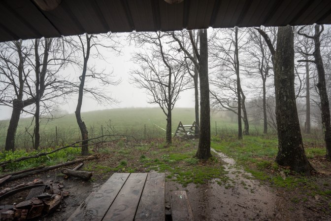
Legs burst into laughter at the sincerity, and intensity of my statement. I was 100% prepared to stop our 20 mile day at 7.8. No one should ever willfully hike into a ferocious storm when they’re dry in a shelter, and have 1500 miles left. We all laughed hard at the shelter graffiti, where Seabiscuit and Baron Von Schinitzelnazi fought for space on the walls.
Thankfully, the rain slowly faded, but walking through the clouds was wet enough. Now and then, the sun tried it’s darnedest to come out, causing a bright fog. It even poked through sometimes! The trail was gentle after the initial climb, so we cruised while listening to Harry Potter on audiobook.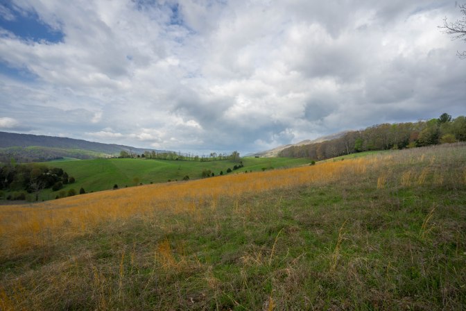
We plan and execute 20 mile days with relative ease now, which is more than enough to finish the trail. Legs’ leg felt better, and we hit the shelter with plenty of light. The crew was there already, including a new face, Bridgette. She was Oz’s friend who was on the trail,
“To hike as far as I can. Maybe Gotham, Maybe Katahdin.”
Most of the crew was already in their sleeping bags as they had a head start on us from Pearisburg, but only hiked 10 miles that day.
The shelter was technically closed because of dangerous deadfall. We tried to find a spot to camp away from the area, but to no avail. The shelter seemed safe enough, but was full, except for the dirt floor in front of the fireplace. We grabbed those gross spots and set up our pads. When laying down, we could see under the bunks. Years of litter, and mouse damage, and dark, inky corners, where the light didn’t penetrate. I saw at least three mice before putting my head down. To those future hikers out there, mice will crawl on you at least once if you sleep in shelters.


April 20th, 2017
Pine Swamp Branch Shelter – Laurel Creek Shelter
18.5 miles
We made our way north the next morning with a classic 9am start. The day was warm, and sunny, so we felt ok in our laziness. After several flat miles, a spur trail led to the right, where a river could be heard. We walked to it, and came to a makeshift zip-line. It led to The Captain’s, a trail angel and purveyor of free porch sodas to any hikers who come across the river. Legs and I used the line, simply because it would be the only one on the trail. The Captain wasn’t home, but his dog was, and the aforementioned sodas were on the porch. We left via the zip-line, this time having Stache pull us back across.
The trail took a downward turn as the day progressed, becoming an uneven pile of rocks and roots. With every step, my foot would come down at a different angle, putting just a little bit more strain and pressure on my knees and ankles. Legs began to succumb to the pain, and tedium of the trail obstacles. To make matters worse, the weather began to deteriorate. It would rain on us for brief, but intense moments. Just before being able to dry, it would hit us again.
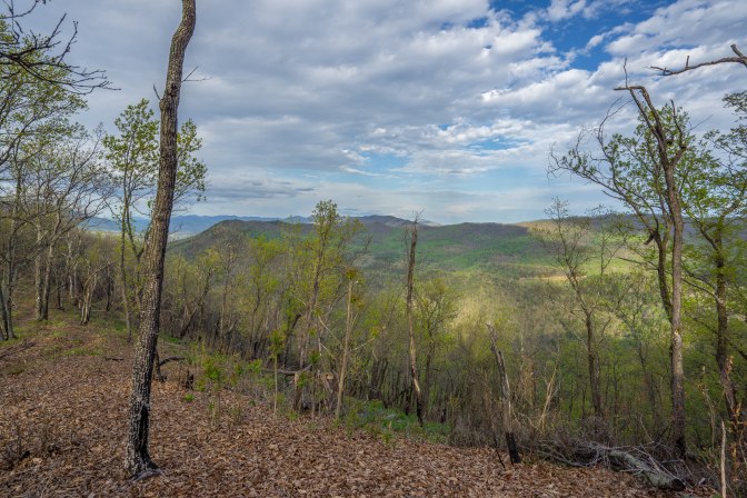
The day was very formulaic; A steep climb to a flat, rocky ridge, followed by a steep descent. Rinse, and repeat. After War Branch Shelter, we hit our last steep climb of the day. With so many things working at our armor, we didn’t even stop to look at the Kelly Knob vista.
Oz’s friend Bridgette, after several large days, bailed. It would be hard for anyone to hop on 700 miles in.
April 21st, 2017
Laurel Creek Shelter – Pickle Branch Shelter
22.5 miles
The terrain was strikingly similar to yesterday’s, even sporting a similar elevation profile in AWOL’s guide. Rocks, roots, and steep climbs to flat ridges, punctuated by a telephone line every few miles. Water rationing is a concern, because when on a ridge, any source is going to be at least .4 down a steep descent.
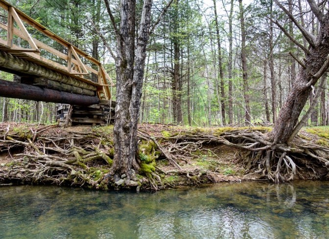
Many stopped at Sarver Hollow Shelter and made the .6 descent to the water, but Legs and I pushed on, passing Niday Shelter as well. We stopped at the banks of Craig Creek, after crossing a wooden foot bridge. We wrapped around underneath the bridge, and reclined on a small, sandy beach.
We stripped down and entered the cool, clear water, letting our tight legs numb up. It was glorious. Our ancestors would be proud of us. We were doing something humans have been doing for thousands of years. We took our time, thinking the tramily would catch up to us, and likely join us in the water. We waited, and waited. The rain showed up first. We huddled under the wooden footbridge, which was just wide enough to accommodate us, but also porous enough to get slightly sprayed. I loved it. To me, there is nothing better than huddling under a small structure in the rain. Weather a tent, or a thick tree, it makes me so giddy. Have you ever seen a 6’6”, bearded man, being giddy under a bridge in the woods? Yea, it isn’t good.
We continued north, climbing to the crest of Brush mountain, where a wooden bench sat along an old woods road. In my opinion, this is the best bench on the AT. Just after the bench, a side trail took us to the Audie Murphy Monument, placed there to honor the most decorated soldier of WWII.
We arrived at Pickle Branch Shelter to find it filled with a few yellow blazers and section hikers. Oz, Stache, and Machine were already enjoying camp, but the rest were nowhere to be found. Strider, Wet Wipes, and Glim-Glom eventually showed up at midnight, having night hiked 10 miles from Niday Shelter. They thought it was a good idea, spearheaded by Wet Wipes, to take a 6 hour break earlier in the day.
April 22nd, 2017
Pickle Branch Shelter – Catawba Mountain Shelter
14.6 miles
Resupply Day
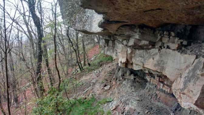
We woke to rain, packed up to rain, and hiked out to rain. The terrain was likely interesting, but we couldn’t see much through the clouds. We started with a climb to Cove Mountain, where a side trail led to the Dragon’s Tooth. Normally, views would be incredible from this wall of rock, shaped like a giant fang. Today, it was grey and cold. Still, the dark stone of the fang did look eery in the bright mist.
From the Dragon’s Tooth, the trail begins a steep descent. This is not your normal Virginia downhill. 1300 feet of steep, stone slabs, and down climbs. It was wet and slippery, and Legs took a big fall on her butt. It would blossom into a proper bruise. We hitched into Catawba at the second road, and got dropped off at The Home Place. It’s a family style, all you can eat, southern comfort restaurant. Basically, they bring you never ending servings of fried chicken, country ham, roast beef, mashed potatoes, string beans, biscuits, Mac and cheese, pinto beans, etc. We helped ourselves to at least 3 of everything and regretted nothing.
Unfortunately, the only resupply option was a gas station with limited options. There is a post office, but check the hours. We stopped at the hostel in the area to see what it was like. There was a lot of chickens and floor space.
(It was so wet today, no cameras came out.)
April 23rd, 2017
Catawba Mountain Shelter – Daleville, VA
17.8 miles
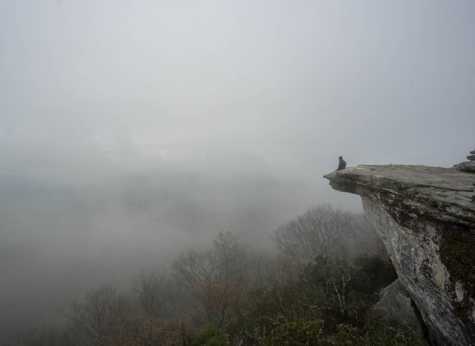
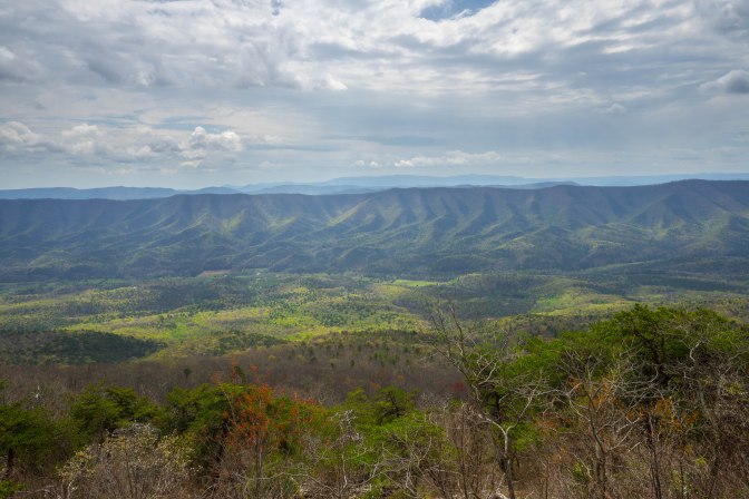
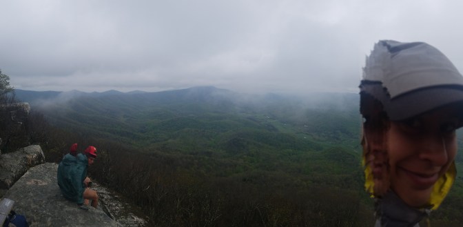
Rain, again. All night, and morning. We began hiking in a lull, but made our way up to McAfee Knob with somber hearts. McAfee Knob is one of the most famous places on the AT. A dramatic, stone cliff looking down on a verdant valley. Hikers usually stand on the edge and look out to the sweeping views. We stood on the edge, and stared out… into a milky void. Some piece of shit day hiker said some comment like,
“Oh, ten minutes ago, it was clear.”
I wanted to throw the guy off the cliff. Don’t say that to someone. I was very bummed the view was so poor. Just like Dragon’s Tooth, we had missed another vista.


After McAfee, the trail thankfully found it’s way into a boulder field, and became delightfully difficult. It took my mind off the missed opportunity, as it was actually a little tricky. At one point, the trail seems to take a natural path through the boulders and under the cliffs. Enough people had made the same mistake, and a trail has been formed. The AT actually cuts back, away from the ‘obvious’ trail. Machine took this bypass, but luckily it looped back to the AT. He missed a sweet spot though, the Tinker Cliffs.
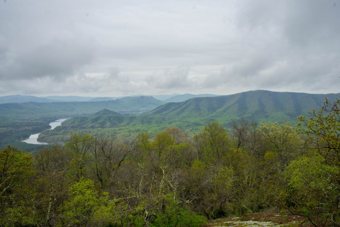
I’ll never forget the Tinker Cliffs, and the time I spent there. Running half a mile along the literal edge of a 60 foot cliff, the Tinker Cliffs are a little gem overshadowed by nearby big brother, McAfee. The view was still obscured by clouds, but every now and then, a window would open in the void. Through the gap lay a rippling, green valley, and across, an adjacent ridge line mirroring our own. We sat on a long, flat rock on the edge of the cliffs. We stayed a long time, and conversed. The whole tramily was there, Strider, Wet Wipes, Glim-Glom, and Oz. Winter and Stache kept hiking, and Machine was nowhere to be seen. A new face, Jumanji, joined in on our epic conversation.
At some point we heard a sound from below, a faint call. It was Glim-Glom, who had fallen into the same trail trap as Machine. He exclaimed,
“Are you guys up there?!”
I peered over the edge and saw him standing, 60 feet down, wearing his yellow rain poncho. Glim-Glom is a little ray of sunshine during a grey day. He backed up and eventually found his way to us, joining the conversation.
We all left at different times, following the rest of the cliffs, and looking for new ‘nature challenges’, like jumping between gaps in the rocks. The trail was a good showing of classic Virginia. Not too hard, not too easy. Power line, view, power line, view. You know, Virginia.
On Hay Rock, we saw the storm. It was a big one, and the thickest part of the clouds would pass right over us. Legs and I booked it, but of course, there’s no out running nature. Right at the opening for another power line, it started. Within moments, we were drenched to the bone, like we just got out of a lake. Going the opposite direction of us, a trail runner zoomed by.
We had no plan for our campsite, as we needed to be near the road for the outfitter. It would open the next day at 10am. We never expected to get to the road crossing soaking wet and thoroughly put off.
TRAIL TERM
— Trail Magic —
A spontaneous act of generosity, kindness, or serendipity from the goodness of a stranger’s heart, to make your life better.
In the incalculable way the Trail works, we finished at the same time as the trail runner we had saw earlier. We approached him, bedraggled, and asked for a quick ride to Kroger’s. His name was Ronnie, and he had no problem giving Legs and I, and then Oz, a ride. In the parking lot of Kroger’s, he asked us where we were staying that night. We mumbled some nonsense about stealth camping near the road. Without hesitating, he turned his car around, and drove us to his house.
Ronnie and Kimberly live in a lovely house north of Daleville. Originally, Ronnie brought the three of us home, but as soon as Kimberly heard there were more hikers, they picked up Strider, Wet Wipes, and Glim-Glom too! Their generosity was incredible, even convincing us to stay another day, and giving us their red convertible for us to all squeeze in and see a movie! I can’t believe how amazing they are!
(WE FINISHED RONNIE & KIM!!! AND GOT ENGAGED!!!)
